海洋応用科学部門
海洋生物増養殖分野
海洋生物研究を基盤とした沖縄における水産ネットワークの形成
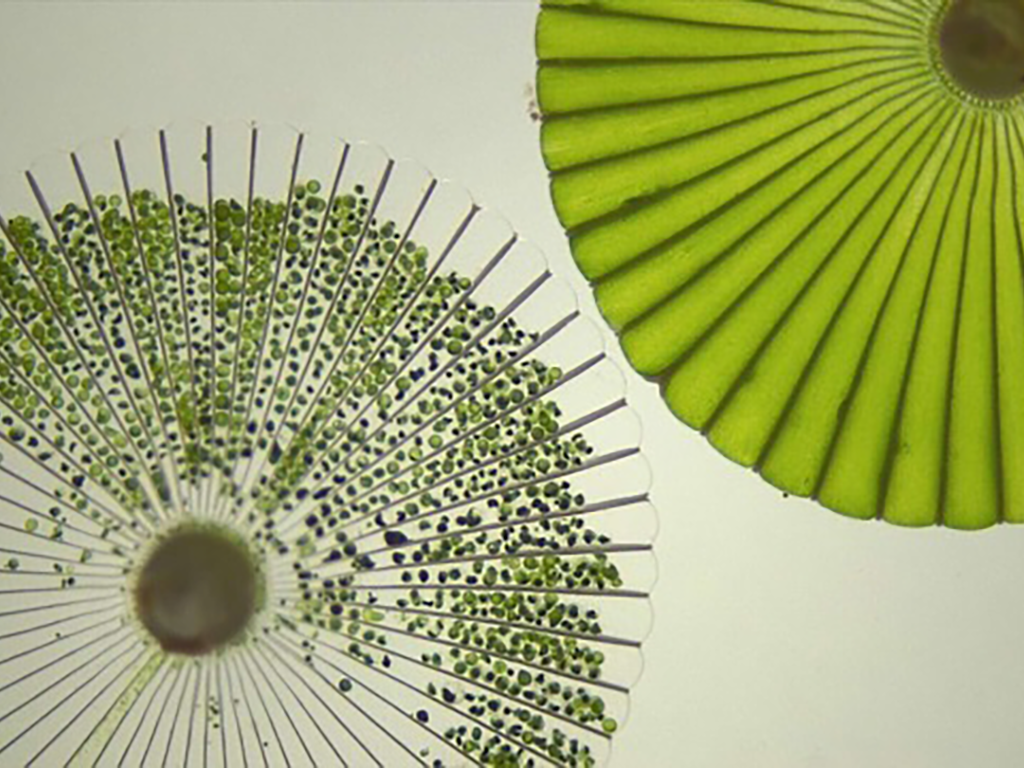
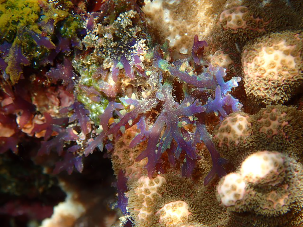
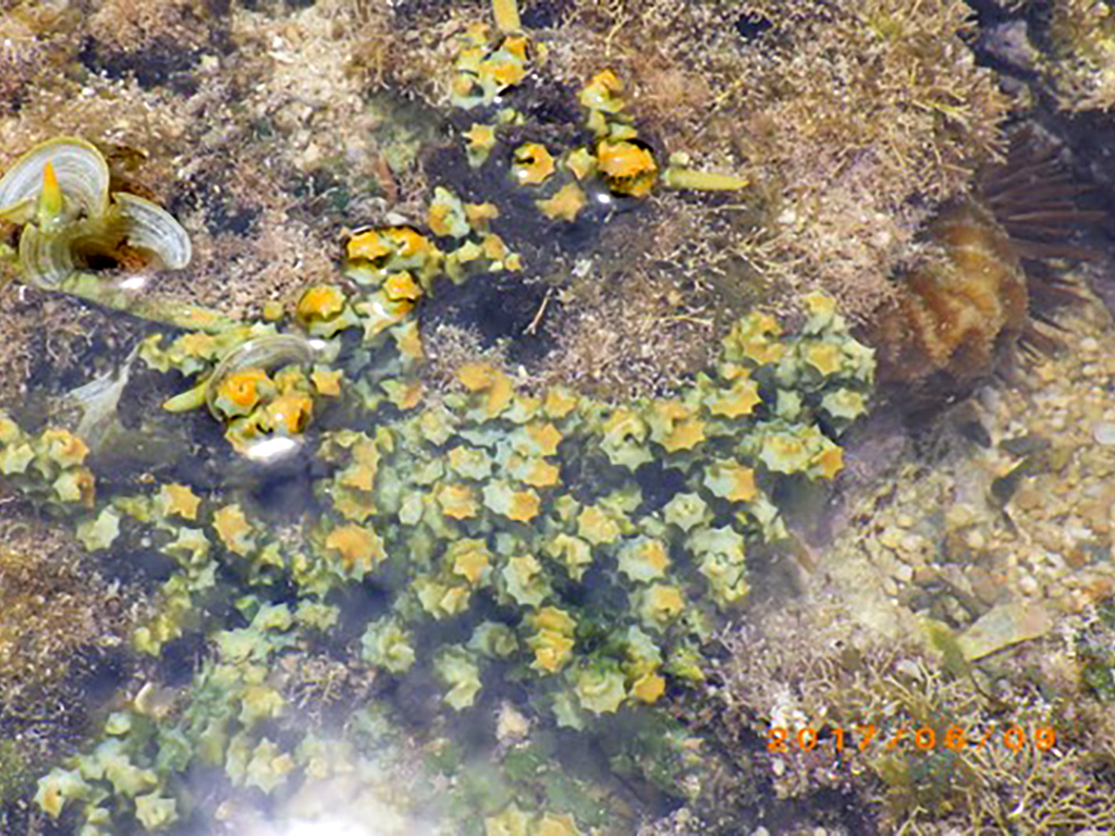
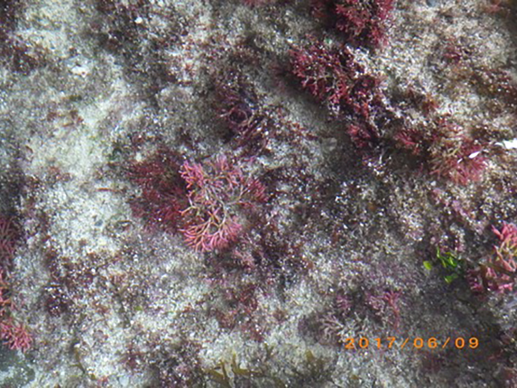
広大な海洋に囲まれた琉球列島は海洋生物資源の宝庫であり、沖縄ではサンゴ礁から沖合までの様々な海域に生息する生物を漁獲・利用している。沖縄県や国の水産研究機関等では産業上重要な魚介類の資源管理や増養殖事業を行っているが、資源の減少に歯止めはかかっていないことに加え、水産養殖業者の要求に応えるだけの種苗生産ができていないのが現状である。近年、沖縄の地理的優位性に着目した物流拠点が形成されつつあり、温帯性の海洋生物の陸上養殖のニーズも高まっている。このことから、従来型の地域内の水産研究に加えて、国際的な視野に立ったニーズプル型のグローバルな水産研究も必要になってくる。
本研究の目的は、本学において海洋生物資源に関する研究を行っている研究者を集め、沖縄県における水産業振興に資する研究を展開しつつ、本研究の成果を基盤として、水産ネットワークの形成を模索することである。
Marine Biology and Aquaculture Section
Building a fishery science network in Okinawa as a marine biology research platform
The Ryukyu Archipelago, surrounded by a vast extent of sea, is blessed with rich marine organisms. Historically people in Okinawa have been engaged in fishing of these resources from coral reef to offshore. Okinawa prefectural and national public institutions including institution of fisheries science have invested in sustainable resource management and aquaculture projects for years, however, still the trend of resource degradation continues. On the hand, the level of seed propagation that will meet the demand of fishery farming company is far from enough, and geographical superiority of Okinawa has attracted the business of logistic base recently. It means that the needs for land culture of marine lives of temperate zone is being higher than ever before. Thus, the development of needs-pull type of marine research with a global perspective is an important topic to tackle.
The purpose of this research is to establish a fishery science network as a platform of our research results. We conduct a research to contribute to fishery industry of Okinawan people by orchestrating the expertise of the researchers from related fields.
海洋域自然災害分野
海洋域自然災害科学に関する研究ネットワーク形成
【目的・目標】
このプロジェクトは、海に囲まれた本学が直面する地理的特性に起因した自然災害のなかで、地震津波および台風を中核とする研究をおこない、海洋域の自然災害科学に関する研究基盤を発展させた拠点形成を目指す。
【必要性・緊急性】
亜熱帯気候である沖縄は台風の常襲地帯であり、台風の進路・強度を精度よく予測することは台風災害を低減させる上で不可欠である。台風の進路・強度予測は近年大きな進展が見られるものの、予測の精度向上には改善する余地がまだ多く残されており、必要性・緊急性が高い。かつ台風の予測精度向上は、同様の台風被害に見舞われる北西太平洋地域にとっても重要性の高い課題である。
2011年東北地方太平洋沖地震津波の教訓を踏まえ、日本各地で巨大地震・津波に対する対策が急速に進められている。琉球海溝では巨大津波から既に250年近く経過しており、次の巨大津波はいつ起こってもおかしくない状態になっている。地震・津波による被害の軽減に向けた取り組みが早急に必要であり、その基礎となる大地震・大津波に起因する災害ポテンシャルの評価と地域への影響評価の実施は喫緊の課題である。また地震に伴って、または地震と関係なく発生する海底地すべりは、局所的であるが大津波を発生させる要因である。この評価も海に囲まれた島嶼地域では重要性の高い課題である。
【戦略における位置づけ】
このプロジェクトは、地震津波・台風を主とした海洋自然災害研究分野のネットワーク化を軸に、関係する国内・国外機関との連携体制を構築し、革新的な学術新領域の創出に取り組むものである。本学が戦略2として掲げる「地域に根ざした強み・特色ある研究分野の強化及び横断型プロジェクト研究を基軸にした新展開」および「研究資源を持つ学外機関とも連携した研究推進システムを構築する。」に合致するものである。また、本取組を達成することで、第3期中期目標期間中のビジョンである「新しい学術領域であるTropical Marine, Medical, and Island Sciences (TIMES:熱帯島嶼・海洋・医学研究)の国際的な拠点として『アジア・太平洋地域の卓越した教育研究拠点となる大学』」にも寄与するものである。
【研究内容】
研究は全体として2つのテーマに分けられる。一つは地震・津波研究、もう一つは台風研究である。
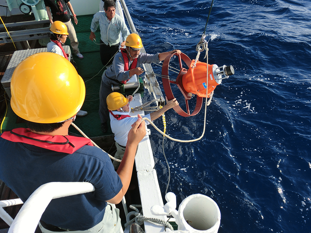
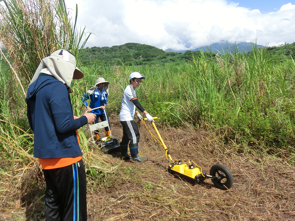
地震・津波研究は、近年めざましい成果を上げてきたGNSS-音響測距結合方式による海底測量システムを用いて海溝域での地震津波ポテンシャルを測定する。観測網の少ない地域での広域的な地震津波ポテンシャルを探るため、近年発見された新たな地震「スロー地震」の特性を活用して地震津波ポテンシャルを推定する。および地震津波痕跡調査を通して、過去の巨大地震の発生履歴およびプレート間巨大地震に関係する応力蓄積の状況とそのプロセスを探る。また海底地形調査等を基にした海底地すべりによる津波ポテンシャルの評価法の開発をおこなう。
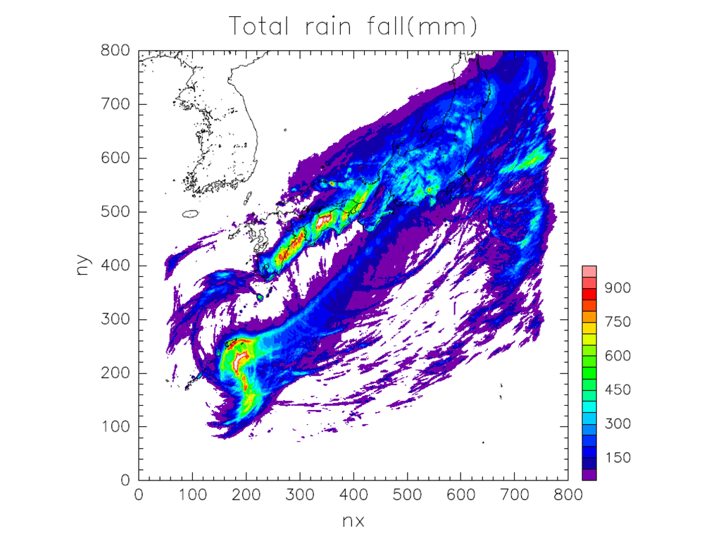
台風災害に関する研究は、気象レーダー等を用いた台風の強度予測システムの開発をおこなう。また、台風や集中豪雨といった自然災害に結び付く顕著現象の解析・予測を精度よく行うため、高解像度数値シミュレーションシステムと人工知能を用いた画像認識の高度化を進める。
【プロジェクト終了後のイノベーションの創出】
プロジェクト終了後には、沖縄ならびに各国の防災関係機関との連携を進めることで、沖縄を北西太平洋全域における海洋域自然災害の総合的な研究拠点のひとつとなる。
The main targets of our research are large earthquakes, tsunamis, and typhoons, which are typical natural disasters that affect the social environment in the Nansei Islands.
In the field of earthquake and tsunami research, we investigate the possibility of occurrence of large interplate earthquakes in the Nansei Islands (Ryukyu Trench) by measuring ocean- bottom crustal deformation. We estimate the possibility of large interplate earthquakes in the Ryukyu using “slow earthquakes,” which have recently been discovered in various mega- earthquake zones. In addition, we are developing a method for evaluating the potential of tsunamis due to submarine landslides. The method is based on submarine topography surveys.
In the field of typhoon disaster research, we develop a system for predicting typhoon intensity using weather radar. In addition, we are improving the sophistication of image recognition using a high-resolution numerical-simulation system and artificial intelligence to analyze and predict accurately the anomalous atmospheric phenomena associated with such natural disasters as typhoons and torrential rains.
Copyright© 2017 ORCHIDS PROJECT All Rights Reserved.